
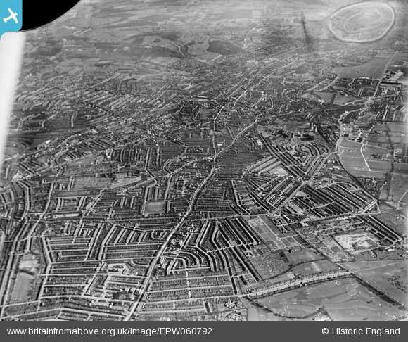
EPW060792 ENGLAND (1939). London Road from Grosvenor House to Broad Green with Croydon in the distance, Thornton Heath, from the north-west, 1939. This image has been produced from a damaged negative.
© Hawlfraint cyfranwyr OpenStreetMap a thrwyddedwyd gan yr OpenStreetMap Foundation. 2025. Trwyddedir y gartograffeg fel CC BY-SA.
Manylion
| Pennawd | [EPW060792] London Road from Grosvenor House to Broad Green with Croydon in the distance, Thornton Heath, from the north-west, 1939. This image has been produced from a damaged negative. |
| Cyfeirnod | EPW060792 |
| Dyddiad | 12-April-1939 |
| Dolen | |
| Enw lle | THORNTON HEATH |
| Plwyf | |
| Ardal | |
| Gwlad | ENGLAND |
| Dwyreiniad / Gogleddiad | 531255, 167520 |
| Hydred / Lledred | -0.11330405797872, 51.391023467362 |
| Cyfeirnod Grid Cenedlaethol | TQ313675 |
Pinnau
 BarbaraB |
Saturday 28th of December 2019 05:18:50 AM | |
BarbaraB |
Saturday 28th of December 2019 05:17:37 AM | |
Johnners |
Tuesday 2nd of July 2013 11:38:49 AM | |
Johnners |
Tuesday 2nd of July 2013 11:37:45 AM | |
Johnners |
Tuesday 2nd of July 2013 11:36:38 AM | |
Johnners |
Tuesday 2nd of July 2013 11:35:44 AM | |
Johnners |
Tuesday 2nd of July 2013 11:34:21 AM | |
Johnners |
Tuesday 2nd of July 2013 11:33:04 AM | |
Johnners |
Tuesday 2nd of July 2013 11:32:13 AM | |
Johnners |
Tuesday 2nd of July 2013 11:30:55 AM | |
Now the site of Sainsburys |
brianbeckett |
Sunday 27th of November 2016 03:43:13 PM |
Johnners |
Tuesday 2nd of July 2013 11:28:59 AM | |
Johnners |
Tuesday 2nd of July 2013 11:27:46 AM | |
Johnners |
Tuesday 2nd of July 2013 11:26:55 AM |