Skip to main content
Prydain oddi Fry
Cymraeg
|
English
Mewngofnod
|
Cofrestru
Toggle navigation
Hafan
Gwaddol
Ynghylch
Map
Orielau
Grwpiau
Cymorth
Chwilio
Pob Gwlad (96344)
Lloegr (82521)
Yr Alban (6398)
Cymru (4321)
Gweddill y Byd (3104)
Gwlad Belg (7)
Ffrainc (27)
yr Almaen (2)
Guernsey (116)
Iran (8)
Irac (6)
Iwerddon (1466)
Ynys Manaw (75)
Jersey (122)
yr Iseldiroedd (20)
Northern Ireland (1163)
Sbaen (9)
y Swisdir (26)
keithb's profile
Gweithgaredd Diweddaraf
Saved Images
first
previous
1
2
3
4
next
last
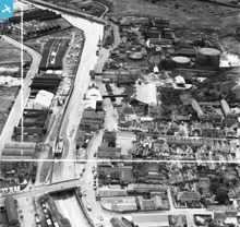
[EAW032330] Frank Pertwee and Sons Ltd Granaries off Hythe Quay and the River Colne, Colchester, 1950. This image was marked by Aerofilms Ltd for photo editing.
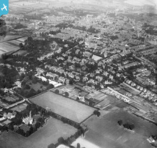
[EPW016645] Queen's Road and environs, Colchester, from the south-west, 1926
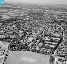
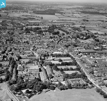
[EAW043689] The site of the Benedictine Abbey of St John and the town, Colchester, from the south, 1952
[EAW043690] The site of the Benedictine Abbey of St John and the town, Colchester, from the south, 1952
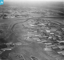
[EAW043667] The northern part of Mersea Island looking towards St Osyth Marsh, Mersea Island, from the west, 1952
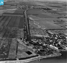
[EAW021058] The Chelmer and Blackwater Navigation, Heybridge Basin, from the south-east, 1949. This image has been produced from a print.
[EAW041013] Freshwater Gravel Pit, Fingringhoe, 1951. This image has been produced from a damaged negative.
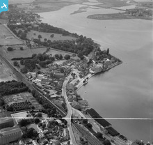
[EAW031057] The High Street and Mistley Quay, Mistley, 1950. This image was marked by Aerofilms Ltd for photo editing.
first
previous
1
2
3
4
next
last
This user has had no activity in the last year.