
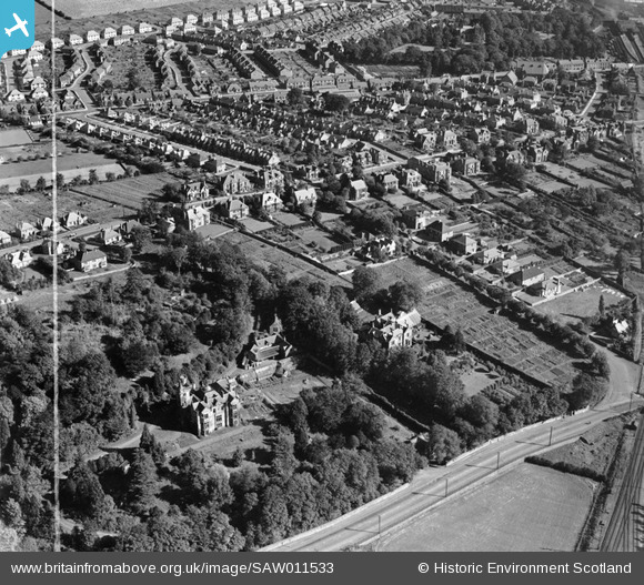
SAW011533 SCOTLAND (1947). Alloa, general view, showing Cowden Park, Stirling Road and Victoria Street. An oblique aerial photograph taken facing east. This image has been produced from a crop marked negative.
© Copyright OpenStreetMap contributors and licensed by the OpenStreetMap Foundation. 2025. Cartography is licensed as CC BY-SA.
Nearby Images (6)
SAW011533

SAW011534

SAW011535

SAW011536

SAW011537

SAW011538

Details
| Title | [SAW011533] Alloa, general view, showing Cowden Park, Stirling Road and Victoria Street. An oblique aerial photograph taken facing east. This image has been produced from a crop marked negative. |
| Reference | SAW011533 |
| Date | 1947 |
| Link | Canmore Collection item 1268754 |
| Place name | |
| Parish | ALLOA |
| District | CLACKMANNAN |
| Country | SCOTLAND |
| Easting / Northing | 287807, 693224 |
| Longitude / Latitude | -3.8047109647379, 56.118620021214 |
| National Grid Reference | NS878932 |
Pins
 pat oholleran |
Monday 15th of December 2014 07:28:21 PM | |
pat oholleran |
Monday 15th of December 2014 07:27:24 PM | |
pat oholleran |
Saturday 26th of October 2013 05:54:09 PM | |
pat oholleran |
Saturday 26th of October 2013 05:48:08 PM | |
BD |
Friday 29th of June 2012 10:32:14 PM | |
BD |
Friday 29th of June 2012 10:31:21 PM |