
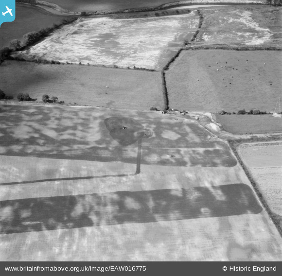
EAW016775 ENGLAND (1948). Fields to the north of Northern Moor near the River Mersey, Northenden, 1948
© Hawlfraint cyfranwyr OpenStreetMap a thrwyddedwyd gan yr OpenStreetMap Foundation. 2025. Trwyddedir y gartograffeg fel CC BY-SA.
Delweddau cyfagos (13)
EAW016775

EAW016772

EAW016770

EAW016491

EAW016767

EAW016490

EAW016493

EAW016492

EAW016766

EAW016771

EAW016773

EAW016769

EAW016495

Manylion
| Pennawd | [EAW016775] Fields to the north of Northern Moor near the River Mersey, Northenden, 1948 |
| Cyfeirnod | EAW016775 |
| Dyddiad | 23-June-1948 |
| Dolen | |
| Enw lle | NORTHENDEN |
| Plwyf | |
| Ardal | |
| Gwlad | ENGLAND |
| Dwyreiniad / Gogleddiad | 382007, 391258 |
| Hydred / Lledred | -2.2707561038337, 53.417558642996 |
| Cyfeirnod Grid Cenedlaethol | SJ820913 |
Pinnau
 John Ellis |
Thursday 27th of November 2014 04:30:07 PM |