
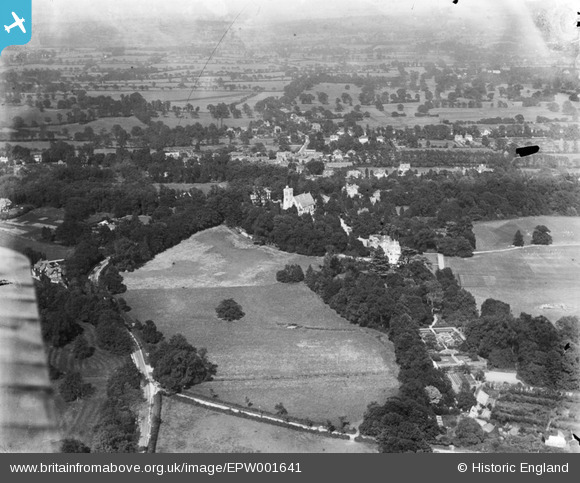
EPW001641 ENGLAND (1920). Stanmore Park and St John's Church, Stanmore, from the west, 1920
© Hawlfraint cyfranwyr OpenStreetMap a thrwyddedwyd gan yr OpenStreetMap Foundation. 2025. Trwyddedir y gartograffeg fel CC BY-SA.
Delweddau cyfagos (2)
EPW001641

EPW001642

Manylion
| Pennawd | [EPW001641] Stanmore Park and St John's Church, Stanmore, from the west, 1920 |
| Cyfeirnod | EPW001641 |
| Dyddiad | June-1920 |
| Dolen | |
| Enw lle | STANMORE |
| Plwyf | |
| Ardal | |
| Gwlad | ENGLAND |
| Dwyreiniad / Gogleddiad | 516383, 192038 |
| Hydred / Lledred | -0.31888191892832, 51.614653050953 |
| Cyfeirnod Grid Cenedlaethol | TQ164920 |
