
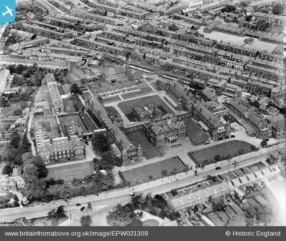
EPW021308 ENGLAND (1928). The Norfolk and Norwich Hospital, Norwich, 1928
© Hawlfraint cyfranwyr OpenStreetMap a thrwyddedwyd gan yr OpenStreetMap Foundation. 2025. Trwyddedir y gartograffeg fel CC BY-SA.
Delweddau cyfagos (4)
EPW021308

EPW021311

EPW021309

EPW021310

Manylion
| Pennawd | [EPW021308] The Norfolk and Norwich Hospital, Norwich, 1928 |
| Cyfeirnod | EPW021308 |
| Dyddiad | 26-May-1928 |
| Dolen | |
| Enw lle | NORWICH |
| Plwyf | |
| Ardal | |
| Gwlad | ENGLAND |
| Dwyreiniad / Gogleddiad | 622564, 307836 |
| Hydred / Lledred | 1.2885539581026, 52.622234098947 |
| Cyfeirnod Grid Cenedlaethol | TG226078 |
Pinnau

Cyfraniadau Grŵp
In the top right hand corner is Bignold school, still a thriving primary school. The Hospital has now moved out of the city center and the buildings have been converted into a large amount of flats. The tennis court is in front of the former nurses home |
 Worms |
Wednesday 27th of June 2012 06:45:50 PM |