
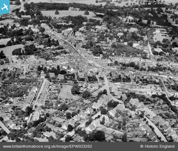
EPW023262 ENGLAND (1928). The town centre, Wokingham, 1928
© Hawlfraint cyfranwyr OpenStreetMap a thrwyddedwyd gan yr OpenStreetMap Foundation. 2025. Trwyddedir y gartograffeg fel CC BY-SA.
Delweddau cyfagos (3)
EPW023262

EPW023255

EPW023256

Manylion
| Pennawd | [EPW023262] The town centre, Wokingham, 1928 |
| Cyfeirnod | EPW023262 |
| Dyddiad | September-1928 |
| Dolen | |
| Enw lle | WOKINGHAM |
| Plwyf | WOKINGHAM |
| Ardal | |
| Gwlad | ENGLAND |
| Dwyreiniad / Gogleddiad | 481247, 168529 |
| Hydred / Lledred | -0.83169194464271, 51.409462667527 |
| Cyfeirnod Grid Cenedlaethol | SU812685 |
Pinnau
 Larkspur |
Wednesday 26th of June 2019 10:37:28 PM | |
Larkspur |
Wednesday 26th of June 2019 10:29:30 PM | |
Larkspur |
Wednesday 26th of June 2019 10:29:05 PM | |
Larkspur |
Wednesday 26th of June 2019 10:28:11 PM | |
Larkspur |
Wednesday 26th of June 2019 10:27:10 PM | |
fatbirdwatcher |
Tuesday 28th of February 2017 05:44:30 AM | |
fatbirdwatcher |
Tuesday 28th of February 2017 05:43:33 AM | |
fatbirdwatcher |
Tuesday 28th of February 2017 05:42:08 AM | |
fatbirdwatcher |
Tuesday 28th of February 2017 05:41:29 AM | |
fatbirdwatcher |
Tuesday 28th of February 2017 05:40:33 AM | |
fatbirdwatcher |
Tuesday 28th of February 2017 05:37:39 AM | |
fatbirdwatcher |
Tuesday 28th of February 2017 05:36:10 AM | |
fatbirdwatcher |
Tuesday 28th of February 2017 05:33:58 AM | |
fatbirdwatcher |
Tuesday 28th of February 2017 05:32:36 AM | |
fatbirdwatcher |
Tuesday 28th of February 2017 05:31:35 AM | |
fatbirdwatcher |
Tuesday 28th of February 2017 05:30:41 AM | |
fatbirdwatcher |
Tuesday 28th of February 2017 05:29:37 AM |