
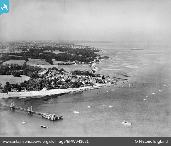
EPW043021 ENGLAND (1933). Nettlestone Point and the coast towards Ryde, Seaview, from the east, 1933
© Hawlfraint cyfranwyr OpenStreetMap a thrwyddedwyd gan yr OpenStreetMap Foundation. 2025. Trwyddedir y gartograffeg fel CC BY-SA.
Delweddau cyfagos (5)
EPW043021

EAW022220

EPW000790

EPW039636

EPW023042

Manylion
| Pennawd | [EPW043021] Nettlestone Point and the coast towards Ryde, Seaview, from the east, 1933 |
| Cyfeirnod | EPW043021 |
| Dyddiad | August-1933 |
| Dolen | |
| Enw lle | SEAVIEW |
| Plwyf | NETTLESTONE AND SEAVIEW |
| Ardal | |
| Gwlad | ENGLAND |
| Dwyreiniad / Gogleddiad | 463147, 91553 |
| Hydred / Lledred | -1.1053684408824, 50.719594882725 |
| Cyfeirnod Grid Cenedlaethol | SZ631916 |
Pinnau
 Charlie Chalk |
Thursday 28th of October 2021 07:06:38 PM | |
Rob |
Wednesday 30th of July 2014 04:25:49 PM | |
 Maurice |
Thursday 29th of August 2013 06:06:49 PM |

