
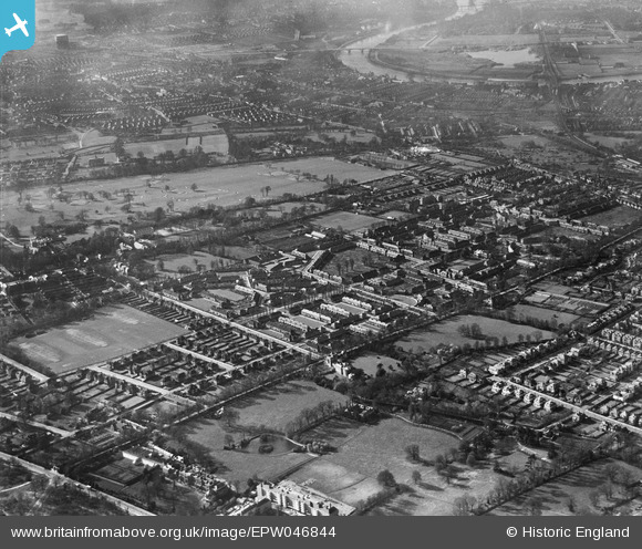
EPW046844 ENGLAND (1935). The Roehampton Club Golf Course and surrounding residential area, Roehampton, 1935
© Hawlfraint cyfranwyr OpenStreetMap a thrwyddedwyd gan yr OpenStreetMap Foundation. 2025. Trwyddedir y gartograffeg fel CC BY-SA.
Delweddau cyfagos (5)
EPW046844

EPW046849

EPW046840

EPW046845

EPW046841

Manylion
| Pennawd | [EPW046844] The Roehampton Club Golf Course and surrounding residential area, Roehampton, 1935 |
| Cyfeirnod | EPW046844 |
| Dyddiad | April-1935 |
| Dolen | |
| Enw lle | ROEHAMPTON |
| Plwyf | |
| Ardal | |
| Gwlad | ENGLAND |
| Dwyreiniad / Gogleddiad | 522401, 174722 |
| Hydred / Lledred | -0.23801857597744, 51.457737121624 |
| Cyfeirnod Grid Cenedlaethol | TQ224747 |
