
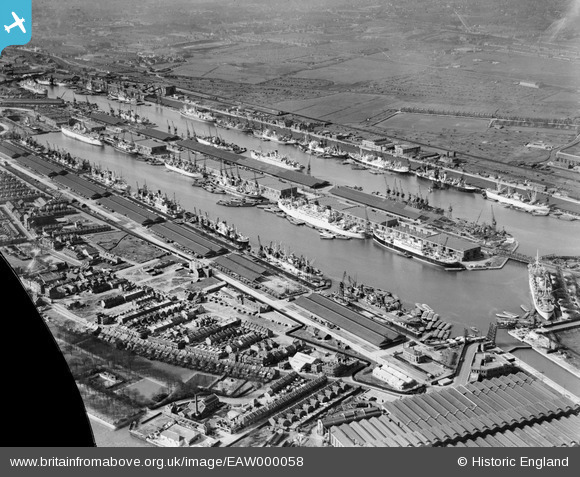
EAW000058 ENGLAND (1946). The King George V Dock and the Royal Albert Dock, Beckton, 1946. This image has been produced from a damaged negative.
© Copyright OpenStreetMap contributors and licensed by the OpenStreetMap Foundation. 2025. Cartography is licensed as CC BY-SA.
Nearby Images (22)
EAW000058

EAW000057

EAW005289

EAW000054

EAW008726

EAW049351

EAW022357

EAW000051

EAW000050

EPW032936

EAW021703

EPW021370

EPW010727

EAW008725

EPW032937

EPW032935

EAW000055

EAW008727

EAW008722

EPW008887

EAW005290

EAW021713

Details
| Title | [EAW000058] The King George V Dock and the Royal Albert Dock, Beckton, 1946. This image has been produced from a damaged negative. |
| Reference | EAW000058 |
| Date | 31-March-1946 |
| Link | |
| Place name | BECKTON |
| Parish | |
| District | |
| Country | ENGLAND |
| Easting / Northing | 543261, 180369 |
| Longitude / Latitude | 0.06436113376902, 51.503589906843 |
| National Grid Reference | TQ433804 |
Pins
 redmist |
Tuesday 30th of June 2020 08:14:40 PM | |
redmist |
Tuesday 30th of June 2020 08:13:54 PM | |
redmist |
Monday 29th of June 2020 07:03:42 PM | |
redmist |
Monday 29th of June 2020 07:00:47 PM | |
baza 1969 |
Friday 19th of January 2018 05:43:30 PM | |
 Sparky |
Tuesday 31st of October 2017 11:59:07 PM |