
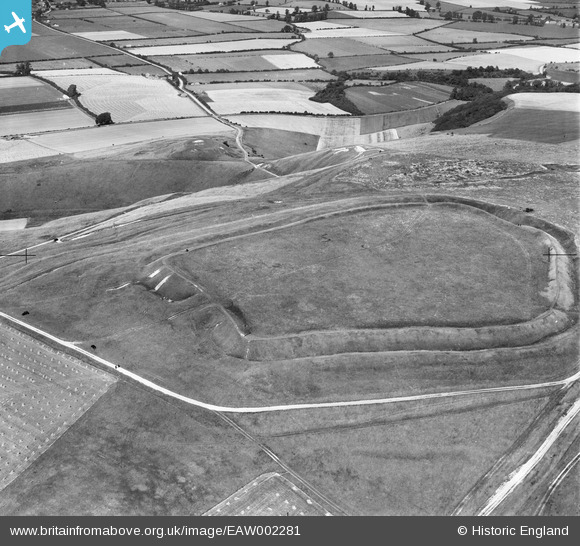
EAW002281 ENGLAND (1946). Uffington Castle, Uffington, 1946
© Copyright OpenStreetMap contributors and licensed by the OpenStreetMap Foundation. 2025. Cartography is licensed as CC BY-SA.
Nearby Images (2)
EAW002281

EAW002280

Details
| Title | [EAW002281] Uffington Castle, Uffington, 1946 |
| Reference | EAW002281 |
| Date | 18-August-1946 |
| Link | |
| Place name | UFFINGTON |
| Parish | UFFINGTON |
| District | |
| Country | ENGLAND |
| Easting / Northing | 429897, 186357 |
| Longitude / Latitude | -1.5685375205093, 51.574810866964 |
| National Grid Reference | SU299864 |
Pins
Be the first to add a comment to this image!
User Comment Contributions
The Uffington White Horse figure can just be made out beyond the hill fort, on the brow of the hill |
 MB |
Friday 29th of November 2013 01:11:32 PM |
Originally a Bronze Age site. Wikipedia has an outline here: http://en.wikipedia.org/wiki/Uffington_Castle The ditches appear much deeper when seen at ground level |
MB |
Friday 29th of November 2013 01:10:08 PM |