
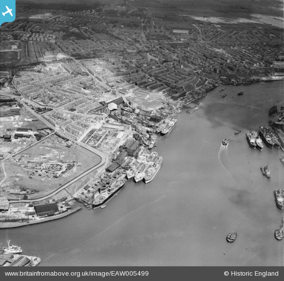
EAW005499 ENGLAND (1947). Smith's Docks, the Bull Ring Graving Docks and the town, North Shields, 1947
© Copyright OpenStreetMap contributors and licensed by the OpenStreetMap Foundation. 2025. Cartography is licensed as CC BY-SA.
Nearby Images (9)
EAW005499

EAW005500

EAW005505

EAW005498

EPW019844

EAW005501

EAW005504

EAW005502

EAW005503

Details
| Title | [EAW005499] Smith's Docks, the Bull Ring Graving Docks and the town, North Shields, 1947 |
| Reference | EAW005499 |
| Date | 15-May-1947 |
| Link | |
| Place name | NORTH SHIELDS |
| Parish | |
| District | |
| Country | ENGLAND |
| Easting / Northing | 435535, 567524 |
| Longitude / Latitude | -1.4444227235042, 55.000945945194 |
| National Grid Reference | NZ355675 |
Pins
 Adam |
Thursday 25th of February 2021 04:34:42 PM | |
Adam |
Thursday 25th of February 2021 04:33:03 PM | |
Adam |
Thursday 25th of February 2021 04:32:22 PM | |
Adam |
Thursday 25th of February 2021 04:31:29 PM | |
Adam |
Thursday 25th of February 2021 04:26:47 PM | |
Adam |
Thursday 25th of February 2021 04:26:26 PM | |
redmist |
Thursday 2nd of May 2019 11:37:40 PM |