
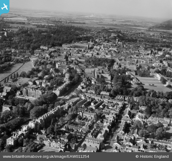
EAW011254 ENGLAND (1947). The city, Cambridge, from the south-east, 1947
© Copyright OpenStreetMap contributors and licensed by the OpenStreetMap Foundation. 2025. Cartography is licensed as CC BY-SA.
Nearby Images (6)
EAW011254

EPW025480

EPW000052

EPW059040

EAW002928

EAW011255

Details
| Title | [EAW011254] The city, Cambridge, from the south-east, 1947 |
| Reference | EAW011254 |
| Date | 30-September-1947 |
| Link | |
| Place name | CAMBRIDGE |
| Parish | |
| District | |
| Country | ENGLAND |
| Easting / Northing | 545208, 257601 |
| Longitude / Latitude | 0.12484394745236, 52.197090127549 |
| National Grid Reference | TL452576 |
Pins
 |
 incony |
Sunday 19th of March 2023 11:12:12 AM |
john |
Sunday 8th of June 2014 06:22:01 PM |