
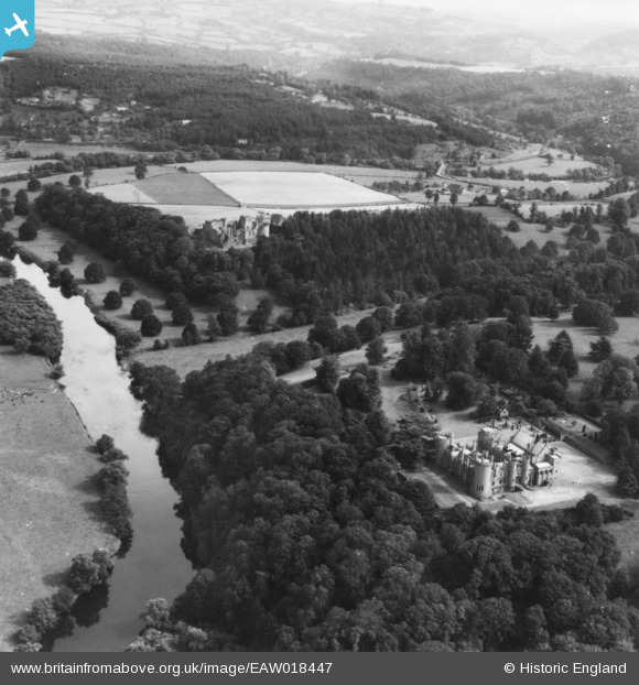
EAW018447 ENGLAND (1948). Goodrich Court and Goodrich Castle, Goodrich, from the north-west, 1948. This image has been produced from a print.
© Copyright OpenStreetMap contributors and licensed by the OpenStreetMap Foundation. 2025. Cartography is licensed as CC BY-SA.
Nearby Images (4)
EAW018447

EAW018445

EAW018448

EAW018446

Details
| Title | [EAW018447] Goodrich Court and Goodrich Castle, Goodrich, from the north-west, 1948. This image has been produced from a print. |
| Reference | EAW018447 |
| Date | 30-August-1948 |
| Link | |
| Place name | GOODRICH |
| Parish | GOODRICH |
| District | |
| Country | ENGLAND |
| Easting / Northing | 357201, 220346 |
| Longitude / Latitude | -2.6218286668524, 51.8795953384 |
| National Grid Reference | SO572203 |
Pins
 Nowy Paul |
Tuesday 18th of February 2025 04:48:02 PM | |
Nowy Paul |
Tuesday 18th of February 2025 04:29:31 PM | |
Nowy Paul |
Tuesday 18th of February 2025 04:17:07 PM | |
Nowy Paul |
Tuesday 18th of February 2025 04:13:40 PM |