
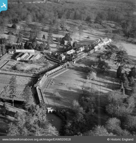
EAW020618 ENGLAND (1948). Dropmore House, Dropmore, 1948
© Copyright OpenStreetMap contributors and licensed by the OpenStreetMap Foundation. 2025. Cartography is licensed as CC BY-SA.
Nearby Images (11)
EAW020618

EAW020623

EAW020624

EAW020614

EAW020616

EAW020620

EAW020615

EAW020619

EAW020622

EAW020617

EAW020621

Details
| Title | [EAW020618] Dropmore House, Dropmore, 1948 |
| Reference | EAW020618 |
| Date | 8-December-1948 |
| Link | |
| Place name | DROPMORE |
| Parish | TAPLOW |
| District | |
| Country | ENGLAND |
| Easting / Northing | 492540, 186047 |
| Longitude / Latitude | -0.66475334211799, 51.565220237814 |
| National Grid Reference | SU925860 |
Pins
Be the first to add a comment to this image!