
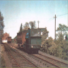
EAW031755 ENGLAND (1950). Part of the Shell Haven Oil Refinery, Corringham, 1950. This image was marked by Aerofilms Ltd for photo editing.

© Copyright OpenStreetMap contributors and licensed by the OpenStreetMap Foundation. 2025. Cartography is licensed as CC BY-SA.
Nearby Images (13)
EAW031755

EAW034228

EAW034225

EAW021798

EAW034230

EAW034227

EAW034229

EAW034224

EAW031754

EAW031752

EPW032108

EAW003533

EAW003532

Details
| Title | [EAW031755] Part of the Shell Haven Oil Refinery, Corringham, 1950. This image was marked by Aerofilms Ltd for photo editing. |
| Reference | EAW031755 |
| Date | 4-August-1950 |
| Link | |
| Place name | CORRINGHAM |
| Parish | |
| District | |
| Country | ENGLAND |
| Easting / Northing | 572560, 182099 |
| Longitude / Latitude | 0.48700881079894, 51.51094626607 |
| National Grid Reference | TQ726821 |
Pins
 Corringham Light Railway |
Friday 26th of September 2014 12:10:22 PM |