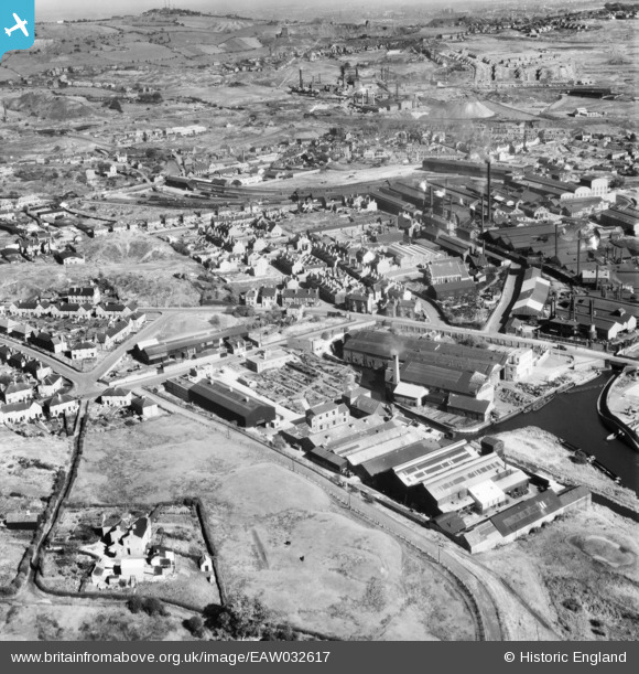
EAW032617 ENGLAND (1950). The Clydesdale Stamping Co Ltd Atlas Works, Lloyds Proving House and environs, Primrose Hill, 1950
© Copyright OpenStreetMap contributors and licensed by the OpenStreetMap Foundation. 2025. Cartography is licensed as CC BY-SA.
Nearby Images (9)
EAW032617

EAW032612

EAW032619

EAW032616

EAW032613

EAW032615

EAW032614

EAW032618

EAW032620

Details
| Title | [EAW032617] The Clydesdale Stamping Co Ltd Atlas Works, Lloyds Proving House and environs, Primrose Hill, 1950 |
| Reference | EAW032617 |
| Date | 18-September-1950 |
| Link | |
| Place name | PRIMROSE HILL |
| Parish | |
| District | |
| Country | ENGLAND |
| Easting / Northing | 394533, 287527 |
| Longitude / Latitude | -2.080516386209, 52.485266219613 |
| National Grid Reference | SO945875 |
Pins
 R J Steward |
Friday 30th of May 2025 10:55:47 AM | |
R J Steward |
Friday 30th of May 2025 10:32:17 AM | |
R J Steward |
Friday 30th of May 2025 10:05:30 AM | |
R J Steward |
Friday 30th of May 2025 10:02:21 AM | |
R J Steward |
Friday 30th of May 2025 09:59:53 AM | |
R J Steward |
Friday 30th of May 2025 09:37:03 AM | |
R J Steward |
Friday 30th of May 2025 09:36:25 AM | |
R J Steward |
Friday 30th of May 2025 09:35:35 AM | |
R J Steward |
Friday 30th of May 2025 09:34:59 AM | |
Steve |
Wednesday 25th of May 2022 01:44:50 PM | |
 Brianac37 |
Sunday 27th of October 2019 11:06:13 AM | |
Steve |
Wednesday 3rd of October 2018 11:53:08 AM | |
Martin |
Sunday 27th of April 2014 09:30:06 PM |