
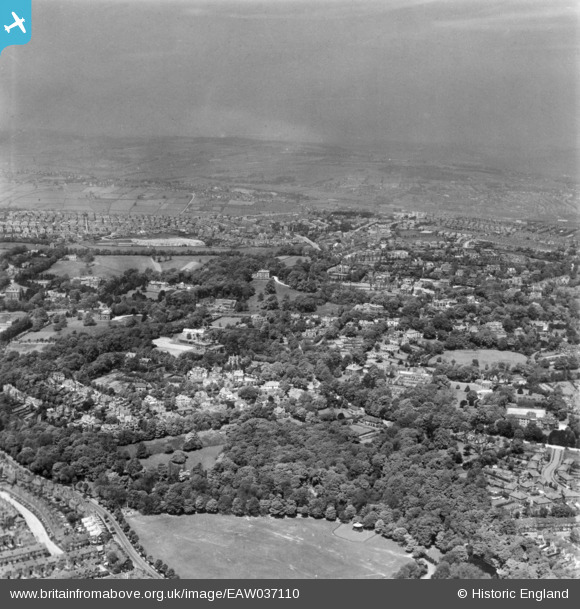
EAW037110 ENGLAND (1951). Endcliffe Park, Tapton Hill and environs, Sheffield, from the south-east, 1951. This image has been produced from a print.
© Copyright OpenStreetMap contributors and licensed by the OpenStreetMap Foundation. 2025. Cartography is licensed as CC BY-SA.
Nearby Images (8)
EAW037110

EAW037111

EAW037109

EAW031271

EAW031274

EAW031272

EAW031273

EAW031399

Details
| Title | [EAW037110] Endcliffe Park, Tapton Hill and environs, Sheffield, from the south-east, 1951. This image has been produced from a print. |
| Reference | EAW037110 |
| Date | 5-June-1951 |
| Link | |
| Place name | SHEFFIELD |
| Parish | |
| District | |
| Country | ENGLAND |
| Easting / Northing | 432759, 386017 |
| Longitude / Latitude | -1.5075982841683, 53.369735403744 |
| National Grid Reference | SK328860 |
Pins
Be the first to add a comment to this image!