
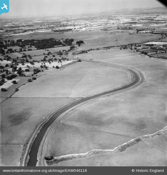
EAW046118 ENGLAND (1952). The River Derwent between Thorganby Ings and East Cottingwith Ings, East Cottingwith, from the south, 1952
© Copyright OpenStreetMap contributors and licensed by the OpenStreetMap Foundation. 2025. Cartography is licensed as CC BY-SA.
Nearby Images (2)
EAW046118

EAW046119

Details
| Title | [EAW046118] The River Derwent between Thorganby Ings and East Cottingwith Ings, East Cottingwith, from the south, 1952 |
| Reference | EAW046118 |
| Date | 22-August-1952 |
| Link | |
| Place name | EAST COTTINGWITH |
| Parish | COTTINGWITH |
| District | |
| Country | ENGLAND |
| Easting / Northing | 469529, 441403 |
| Longitude / Latitude | -0.94261439175073, 53.863973466675 |
| National Grid Reference | SE695414 |
Pins
 Class31 |
Monday 9th of June 2014 12:48:23 PM | |
Class31 |
Monday 9th of June 2014 12:45:50 PM | |
Class31 |
Monday 9th of June 2014 12:45:17 PM | |
Class31 |
Monday 9th of June 2014 12:42:41 PM | |
Class31 |
Monday 9th of June 2014 12:41:57 PM | |
Class31 |
Monday 9th of June 2014 12:41:17 PM |
User Comment Contributions
View is looking north. |
Class31 |
Monday 30th of June 2014 01:49:02 PM |
Hi Class31, thanks for taking a look at this one. We’ll update the catalogue and post your new location details here in due course. Yours, Katy Britain from Above Cataloguing Team Leader |
Katy Whitaker |
Monday 30th of June 2014 01:49:02 PM |
An adjacent photograph was of Selby so I did not have to look too far away for this pair of images. |
Class31 |
Monday 9th of June 2014 12:54:13 PM |
Eureka |
Class31 |
Monday 9th of June 2014 12:40:54 PM |