
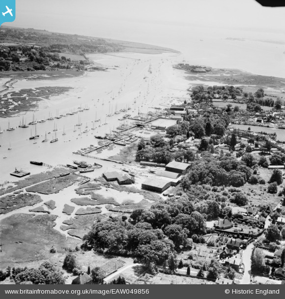
EAW049856 ENGLAND (1953). Port Hamble Ltd and the River Hamble, Hamble-le-Rice, from the north, 1953
© Copyright OpenStreetMap contributors and licensed by the OpenStreetMap Foundation. 2025. Cartography is licensed as CC BY-SA.
Nearby Images (3)
EAW049856

EAW049864

EAW049862

Details
| Title | [EAW049856] Port Hamble Ltd and the River Hamble, Hamble-le-Rice, from the north, 1953 |
| Reference | EAW049856 |
| Date | 9-June-1953 |
| Link | |
| Place name | HAMBLE-LE-RICE |
| Parish | HAMBLE-LE-RICE |
| District | |
| Country | ENGLAND |
| Easting / Northing | 448338, 107368 |
| Longitude / Latitude | -1.3130742105385, 50.863239411252 |
| National Grid Reference | SU483074 |
