
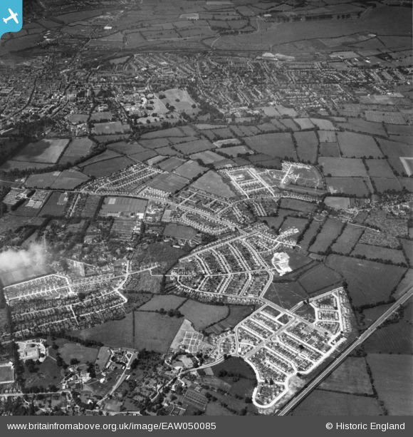
EAW050085 ENGLAND (1953). The development of the New Marston area and the city of Oxford, New Marston, 1953
© Copyright OpenStreetMap contributors and licensed by the OpenStreetMap Foundation. 2025. Cartography is licensed as CC BY-SA.
Nearby Images (3)
EAW050085

EAW050087

EAW003913

Details
| Title | [EAW050085] The development of the New Marston area and the city of Oxford, New Marston, 1953 |
| Reference | EAW050085 |
| Date | 26-June-1953 |
| Link | |
| Place name | NEW MARSTON |
| Parish | |
| District | |
| Country | ENGLAND |
| Easting / Northing | 452887, 207713 |
| Longitude / Latitude | -1.2335451919771, 51.76514368879 |
| National Grid Reference | SP529077 |
Pins
 David Brimson |
Wednesday 7th of May 2025 01:51:01 PM | |
David Brimson |
Wednesday 7th of May 2025 01:50:01 PM | |
David Brimson |
Wednesday 7th of May 2025 01:49:34 PM | |
MikeBellew |
Monday 14th of July 2014 02:47:31 PM |