
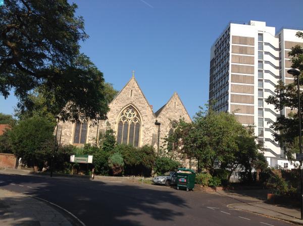
EPW017172 ENGLAND (1926). Larkhall Rise and environs, Clapham, from the south, 1926

© Copyright OpenStreetMap contributors and licensed by the OpenStreetMap Foundation. 2025. Cartography is licensed as CC BY-SA.
Nearby Images (4)
EPW017172

EPW017170

EPW017171

EPW022807

Details
| Title | [EPW017172] Larkhall Rise and environs, Clapham, from the south, 1926 |
| Reference | EPW017172 |
| Date | October-1926 |
| Link | |
| Place name | CLAPHAM |
| Parish | |
| District | |
| Country | ENGLAND |
| Easting / Northing | 529520, 175899 |
| Longitude / Latitude | -0.13516495518431, 51.466731464692 |
| National Grid Reference | TQ295759 |
Pins
 Glyph |
Monday 8th of February 2016 04:30:29 PM | |
Glyph |
Monday 8th of February 2016 04:30:29 PM | |
Glyph |
Monday 8th of February 2016 04:30:29 PM | |
Glyph |
Monday 8th of February 2016 04:30:29 PM | |
Glyph |
Monday 8th of February 2016 04:30:24 PM | |
Sam |
Sunday 28th of September 2014 09:04:01 AM | |
 Class31 |
Tuesday 9th of September 2014 11:24:36 AM | |
ariel |
Saturday 8th of March 2014 11:44:54 PM | |
Class31 |
Monday 11th of March 2013 11:09:14 PM | |
Class31 |
Monday 11th of March 2013 11:04:18 PM | |
Class31 |
Monday 11th of March 2013 11:01:11 PM | |
Class31 |
Monday 11th of March 2013 10:59:21 PM | |
V&C |
Sunday 26th of August 2012 10:38:50 PM | |
V&C |
Sunday 26th of August 2012 10:36:07 PM |
User Comment Contributions
 Larkhall Rise, 08/09/2014 |
Class31 |
Tuesday 9th of September 2014 11:23:50 AM |