
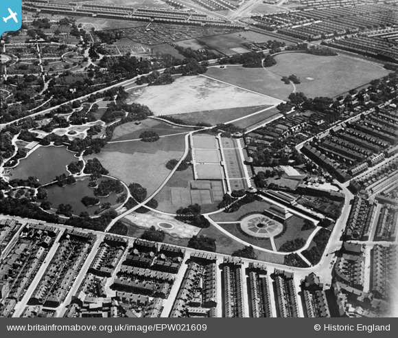
EPW021609 ENGLAND (1928). Stanley Park, Anfield, 1928
© Copyright OpenStreetMap contributors and licensed by the OpenStreetMap Foundation. 2025. Cartography is licensed as CC BY-SA.
Nearby Images (5)
EPW021609

EPW021612

EPW021613

EPW021611

EPW021610

Details
| Title | [EPW021609] Stanley Park, Anfield, 1928 |
| Reference | EPW021609 |
| Date | June-1928 |
| Link | |
| Place name | ANFIELD |
| Parish | |
| District | |
| Country | ENGLAND |
| Easting / Northing | 336007, 393534 |
| Longitude / Latitude | -2.9633512477265, 53.434441334044 |
| National Grid Reference | SJ360935 |
