
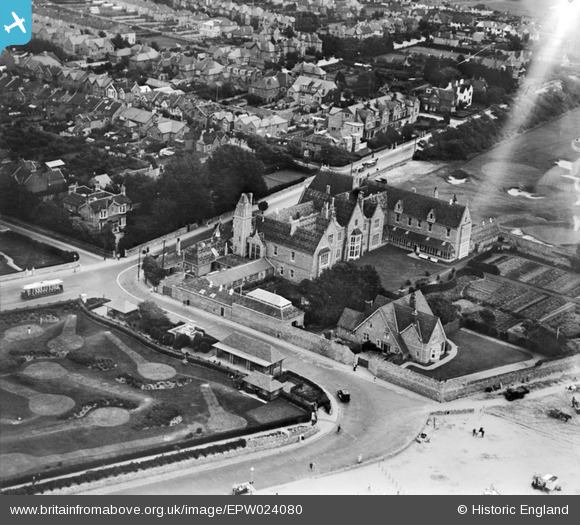
EPW024080 ENGLAND (1928). The Royal West of England Sanatorium, Weston-super-Mare, 1928
© Copyright OpenStreetMap contributors and licensed by the OpenStreetMap Foundation. 2025. Cartography is licensed as CC BY-SA.
Nearby Images (3)
EPW024080

EPW039931

EPW008790

Details
| Title | [EPW024080] The Royal West of England Sanatorium, Weston-super-Mare, 1928 |
| Reference | EPW024080 |
| Date | September-1928 |
| Link | |
| Place name | WESTON-SUPER-MARE |
| Parish | WESTON-SUPER-MARE |
| District | |
| Country | ENGLAND |
| Easting / Northing | 331614, 159916 |
| Longitude / Latitude | -2.9817448302151, 51.333717264968 |
| National Grid Reference | ST316599 |

