
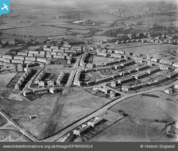
EPW030014 ENGLAND (1929). The Rose Hill Estate, Burnley, 1929
© Copyright OpenStreetMap contributors and licensed by the OpenStreetMap Foundation. 2025. Cartography is licensed as CC BY-SA.
Nearby Images (4)
EPW030014

EPW030013

EPW030015

EPW030016

Details
| Title | [EPW030014] The Rose Hill Estate, Burnley, 1929 |
| Reference | EPW030014 |
| Date | October-1929 |
| Link | |
| Place name | BURNLEY |
| Parish | |
| District | |
| Country | ENGLAND |
| Easting / Northing | 383708, 431122 |
| Longitude / Latitude | -2.2472433857201, 53.775960701346 |
| National Grid Reference | SD837311 |
Pins
 TONYB |
Saturday 6th of January 2024 04:58:26 PM |
User Comment Contributions
Manchester Road running across the photo about a third of the way down |
wadey |
Sunday 4th of May 2014 10:55:55 AM |