
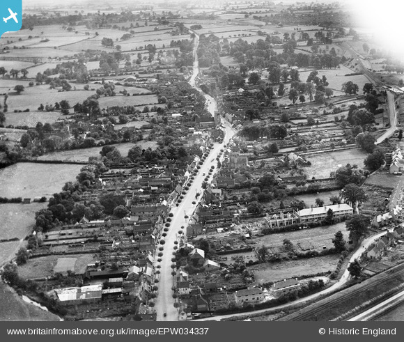
EPW034337 ENGLAND (1930). The High Street, Henley-in-Arden, 1930
© Copyright OpenStreetMap contributors and licensed by the OpenStreetMap Foundation. 2025. Cartography is licensed as CC BY-SA.
Nearby Images (8)
EPW034337

EPW034339

EAW025696

EAW025698

EAW025699

EPW034334

EPW034340

EPW034445

Details
| Title | [EPW034337] The High Street, Henley-in-Arden, 1930 |
| Reference | EPW034337 |
| Date | August-1930 |
| Link | |
| Place name | HENLEY-IN-ARDEN |
| Parish | HENLEY-IN-ARDEN |
| District | |
| Country | ENGLAND |
| Easting / Northing | 415141, 266194 |
| Longitude / Latitude | -1.7779730212436, 52.293276817525 |
| National Grid Reference | SP151662 |
Pins
Be the first to add a comment to this image!