
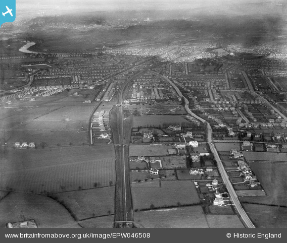
EPW046508 ENGLAND (1935). Residential area surrounding Melton Road, West Bridgford, from the south-east, 1935
© Copyright OpenStreetMap contributors and licensed by the OpenStreetMap Foundation. 2025. Cartography is licensed as CC BY-SA.
Nearby Images (2)
EPW046508

EPW046512

Details
| Title | [EPW046508] Residential area surrounding Melton Road, West Bridgford, from the south-east, 1935 |
| Reference | EPW046508 |
| Date | February-1935 |
| Link | |
| Place name | WEST BRIDGFORD |
| Parish | |
| District | |
| Country | ENGLAND |
| Easting / Northing | 459068, 335775 |
| Longitude / Latitude | -1.1214514970617, 52.915827388273 |
| National Grid Reference | SK591358 |
Pins
 MML |
Tuesday 7th of July 2020 11:57:29 AM | |
MML |
Tuesday 7th of July 2020 11:56:27 AM | |
MML |
Tuesday 7th of July 2020 11:56:08 AM | |
MML |
Tuesday 7th of July 2020 11:55:42 AM | |
MML |
Tuesday 7th of July 2020 11:55:12 AM | |
MML |
Tuesday 7th of July 2020 11:54:38 AM | |
MML |
Tuesday 7th of July 2020 11:53:47 AM | |
MML |
Tuesday 7th of July 2020 11:53:05 AM | |
Yargneb |
Friday 26th of June 2020 10:39:06 AM | |
Yargneb |
Friday 26th of June 2020 10:38:14 AM | |
Yargneb |
Friday 26th of June 2020 10:35:21 AM | |
Yargneb |
Friday 26th of June 2020 10:33:26 AM | |
Yargneb |
Friday 26th of June 2020 10:32:19 AM | |
Yargneb |
Friday 26th of June 2020 10:30:26 AM |