
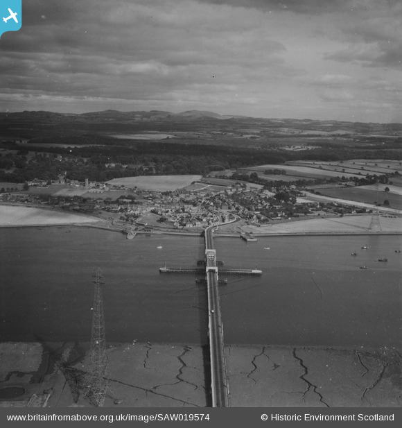
SAW019574 SCOTLAND (1948). Kincardine, general view, showing Kincardine on Forth Bridge and Toll Road. An oblique aerial photograph taken facing east. This image has been produced from a print.
© Copyright OpenStreetMap contributors and licensed by the OpenStreetMap Foundation. 2025. Cartography is licensed as CC BY-SA.
Nearby Images (5)
SAW019574

SAR018851

SAR018852

SPW020287

SPW020288

Details
| Title | [SAW019574] Kincardine, general view, showing Kincardine on Forth Bridge and Toll Road. An oblique aerial photograph taken facing east. This image has been produced from a print. |
| Reference | SAW019574 |
| Date | 1948 |
| Link | Canmore Collection item 1314959 |
| Place name | |
| Parish | TULLIALLAN |
| District | DUNFERMLINE |
| Country | SCOTLAND |
| Easting / Northing | 293163, 687523 |
| Longitude / Latitude | -3.7163207937363, 56.068644371668 |
| National Grid Reference | NS932875 |
Pins
Be the first to add a comment to this image!