
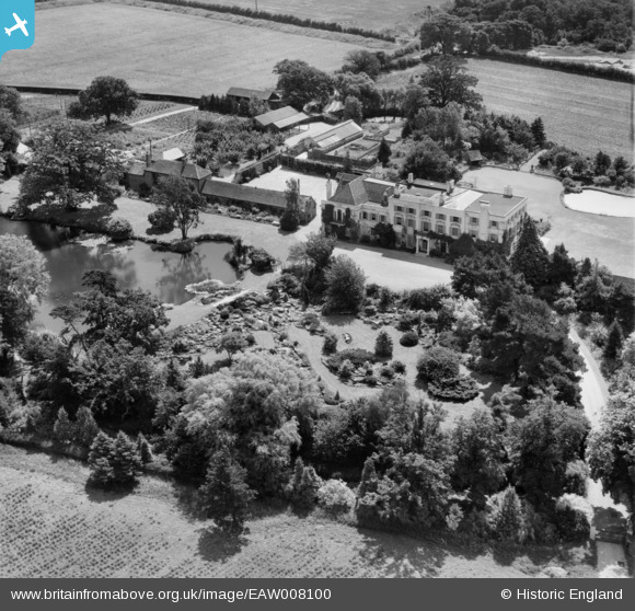
EAW008100 ENGLAND (1947). Thorpe Hall and gardens, Thorpe-le-Soken, 1947
© Copyright OpenStreetMap contributors and licensed by the OpenStreetMap Foundation. 2025. Cartography is licensed as CC BY-SA.
Nearby Images (10)
EAW008100

EAW008097

EAW008096

EAW008102

EAW008101

EAW008099

EAW008098

EAW008105

EAW008103

EAW008104

Details
| Title | [EAW008100] Thorpe Hall and gardens, Thorpe-le-Soken, 1947 |
| Reference | EAW008100 |
| Date | 12-July-1947 |
| Link | |
| Place name | THORPE-LE-SOKEN |
| Parish | THORPE-LE-SOKEN |
| District | |
| Country | ENGLAND |
| Easting / Northing | 618230, 221785 |
| Longitude / Latitude | 1.169065030678, 51.851481156991 |
| National Grid Reference | TM182218 |
Pins
 totoro |
Tuesday 27th of December 2016 12:01:04 PM | |
totoro |
Tuesday 27th of December 2016 12:00:46 PM | |
totoro |
Tuesday 27th of December 2016 12:00:12 PM |