
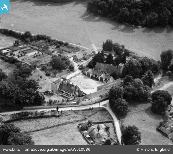
EAW010586 ENGLAND (1947). St Mary's Church and the Manor House, Buriton, 1947
© Copyright OpenStreetMap contributors and licensed by the OpenStreetMap Foundation. 2025. Cartography is licensed as CC BY-SA.
Nearby Images (8)
EAW010586

EAW010589

EAW010590

EAW010585

EAW010587

EAW010588

EAW010584

EAW010583

Details
| Title | [EAW010586] St Mary's Church and the Manor House, Buriton, 1947 |
| Reference | EAW010586 |
| Date | 3-September-1947 |
| Link | |
| Place name | BURITON |
| Parish | BURITON |
| District | |
| Country | ENGLAND |
| Easting / Northing | 474036, 120034 |
| Longitude / Latitude | -0.94536575393211, 50.974410344689 |
| National Grid Reference | SU740200 |
Pins
 totoro |
Friday 7th of August 2015 07:25:40 PM | |
totoro |
Friday 7th of August 2015 07:24:12 PM |