
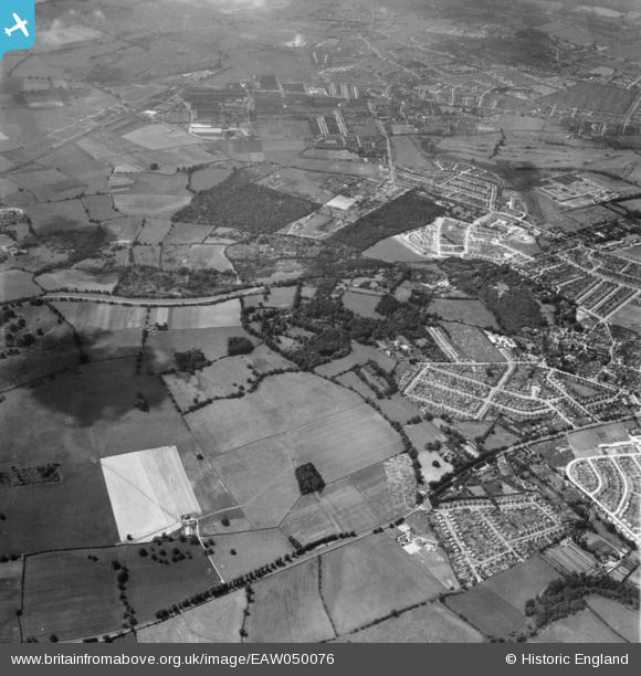
EAW050076 ENGLAND (1953). Housing development around Monk's Wood and Magdalen Wood, Shotover Hill, 1953
© Copyright OpenStreetMap contributors and licensed by the OpenStreetMap Foundation. 2025. Cartography is licensed as CC BY-SA.
Nearby Images (2)
EAW050076

EAW050078

Details
| Title | [EAW050076] Housing development around Monk's Wood and Magdalen Wood, Shotover Hill, 1953 |
| Reference | EAW050076 |
| Date | 26-June-1953 |
| Link | |
| Place name | SHOTOVER HILL |
| Parish | FOREST HILL WITH SHOTOVER |
| District | |
| Country | ENGLAND |
| Easting / Northing | 456305, 206606 |
| Longitude / Latitude | -1.1841951336026, 51.754857063814 |
| National Grid Reference | SP563066 |
Pins
Be the first to add a comment to this image!