
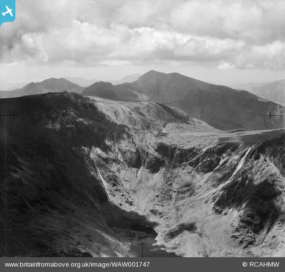
WAW001747 WALES (1946). View of Snowdonia
© Copyright OpenStreetMap contributors and licensed by the OpenStreetMap Foundation. 2025. Cartography is licensed as CC BY-SA.
Nearby Images (20)
WAW001743

WAW001744

WAW001745

WAW001746

WAW001747

WAW001748

WAW001749

WAW017393

WAW017394

WAW017395

WAW017396

WAW020513

WAW020514

WAW020515

WAW020516

WAW020517

WAW020518

WPW055761

WPW055762

WPW055763

Details
| Title | [WAW001747] View of Snowdonia |
| Reference | WAW001747 |
| Date | 11-July-1946 |
| Link | Coflein Archive Item 6413206 |
| Place name | |
| Parish | |
| District | |
| Country | WALES |
| Easting / Northing | 260800, 354500 |
| Longitude / Latitude | -4.0778482327032, 53.069274932495 |
| National Grid Reference | SH608545 |
